Deleted
Deleted Member
Posts: 0
|
Post by Deleted on Oct 25, 2012 21:37:39 GMT -5
So Adam, should I keep my weekend plans?
|
|
|
|
Post by newt on Oct 26, 2012 15:30:04 GMT -5
Sure - assuming you are OK with some rain, the resulting flooding, and 40 kts of wind.
I think we'll have quite a few trees down, some deep puddles, and wide spread power outages, but not enough wind to damage houses.
The real question is what this thing will do as it transitions from a tropical storm and becomes baroclinic - it could get very interesting!
|
|
|
|
Post by CORE 4WD on Oct 26, 2012 18:05:16 GMT -5
So Adam, should I keep my weekend plans? Muddy's last race is now 10Nov Norm....  |
|
|
|
Post by stuck tj on Oct 26, 2012 21:51:21 GMT -5
Adam you were reading my mind on this one!   Why Do Baroclinic Waves Tilt Poleward with Height ABSTRACT Theoretical and modeling studies of nongeostrophic effects in baroclinic waves predict that baroclinic waves should tilt poleward with height, with a larger tilt in total meridional wind than in geostrophic quantities. Regression analysis of NCEP–NCAR reanalysis 6-hourly data demonstrates that observed baroclinic waves do indeed tilt poleward with height, although the observed tilt is smaller than predicted by previous studies. The meridional ageostrophic wind enhances the poleward tilt of meridional wind perturbations, despite being smaller in amplitude than the meridional geostrophic wind by a factor of 5. An improved estimate of the structure of the meridional ageostrophic wind in baroclinic waves is calculated assuming force balance. Several important terms in this estimate have been left out of previous estimates of the meridional ageostrophic wind. Three terms in the improved estimate produce nearly all of the poleward tilt of the meridional wind: 1) the advection of geostrophic zonal wind perturbations by the mean zonal wind, 2) the convergence of the eddy momentum flux, and 3) the effect of friction. The poleward tilt with height of baroclinic waves explains why upper-level storm tracks tend to occur poleward of near-surface baroclinic regions, and may play a role in the midwinter suppression of the Pacific storm track. One of the major concerns of the meteorologist is the degree of predictability of atmospheric motions. The classic remarks made by Lorenz (1963), in the now-celebrated paper in which deterministic equations were first shown to exhibit aperiodic and consequently unpredictable behaviour, that it may be impossible to predict the weather accurately beyond a few days, only too truly reflect the current state of affairs. Although the availability of very fast computers and greater accuracy of initial data have brought about some improvement in weather forecasts, there is still a disappointing limit on the length of time for which a weather prediction can be considered to be accurate. Nevertheless certain features of atmospheric motion are observed to persist for considerable lengths of time, usually associated with what are known as blocking situations (Berggren et al 1949); a notable persistent factor in another planetary atmosphere is Jupiter's Red Spot. Among the models proposed for these phenomena are modons (Fleierl et al 1981) and solitons (Maxworthy and Redekopp, 1976).    |
|
|
|
Post by newt on Oct 27, 2012 8:43:53 GMT -5
Delete that tornado crap - it's got nothing to do w/ SANDY - that is a small scale feature, not synoptic scale.
As to the rest - yup, welcome to my world. The issue is that tropical storms, like SANDY before, are barotropic warm core systems that do not show the features described in your post (jet support, frontal features, effects of vorticity advection, etc). SANDY is morphing from tropical storm to a hybrid system as it interacts w/ the jet and cold front associated w/ the baroclininc low near the great lakes and the huge cold surge pushing down from Canada.
Like I said - very interesting.
|
|
|
|
Post by toynrnd on Oct 27, 2012 14:25:38 GMT -5
 Day After Tomorrow? |
|
|
|
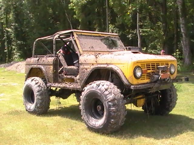
Post by stumper92 on Oct 29, 2012 16:49:30 GMT -5
Here's what "The Mud Pit" looks like out at my place.  |
|